Over the years, I’ve heard from countless organisations who have wanted to make it easy for their users to open Google Street View for features showing on an ArcGIS web map. With Geovonic Connect, it’s incredibly easy to add Street View to your ArcGIS web apps.
Geovonic Connect has a feature called App Launchers. Each App Launcher is linked to a layer on your map, adding functionality to open various business systems such as Google Street View, Civica Authority Altitude, Salesforce, TRIM, Before You Dig Australia and many others.
This short video shows how Geovonic Connect is configured to open Street View for any bus stop shown on the map in ArcGIS Experience Builder. The user clicks on the bus stop to launch Street View in a new tab, showing the bus stop in situ.
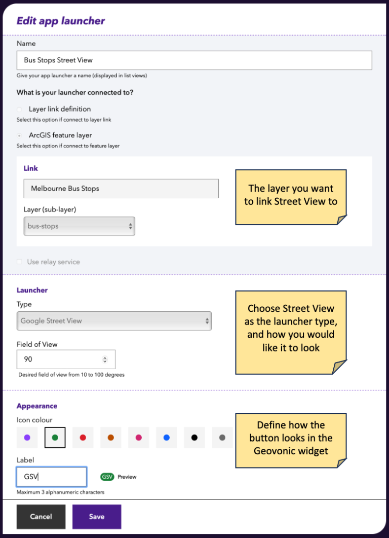
App Launchers are easy to configure in Geovonic Connect. The key is to create a relationship between a layer in your map (in this case Melbourne Bus Stops) and the launcher you want to open (Street View).
Once this is setup, create an app using ArcGIS Experience Builder (or ArcGIS Web AppBuilder) and add the Geovonic Connect widget. That’s all that is required.
Clicking on a bus stop on the map launches Google Street View at that location.
The Google Street View app launcher is included as standard with all Geovonic Connect subscriptions. Start a free trial today on ArcGIS Marketplace or contact us for more details.