
Geovonic Connect allows you to create relationships between features held in your ArcGIS with records stored in your other business systems. A wide range of different connectors is available, including the SQL Query Reader which is used to fetch data from databases, such as MS SQL Server or Postgres.
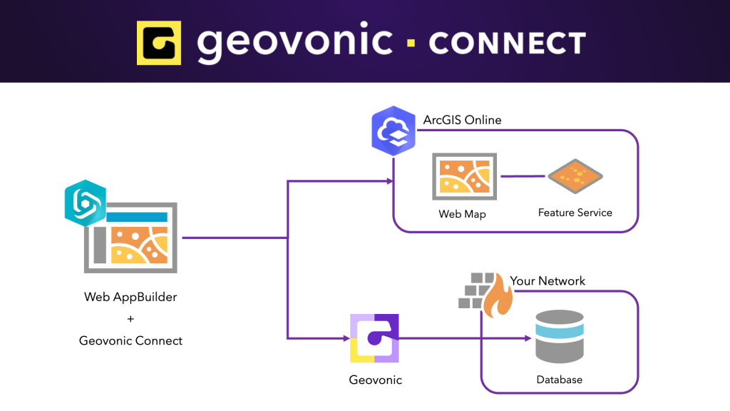
Geovonic Connect works with both ArcGIS Enterprise and ArcGIS Online, and has widgets for use in ArcGIS Experience Builder and ArcGIS Web AppBuilder.
The video below steps through the process of configuring Geovonic Connect and deploying the widget into an ArcGIS Web AppBuilder application. In the video you see the following steps: –
- Selecting a Web Map that contains the features you wish to link with external data.
- Configuring a Data Source – defines how Geovonic Connect will open up a connection to your database.
- Adding a Layer Link – the relationship between a feature on your web map with records in your database.
- Building a Web AppBuilder application – add the Geovonic Connect widget to your application instantly fetch data from your database.